
Womp womp.
I thought that the gate at the Hogtown junction was closed only when the road was impassible due to snow. I asked a fella out on his morning constitutional if he knew why the gate was shut. He informed me that the gate also gets closed in March for a couple of weeks during mud season. Bummer for me, but that does make sense. The road is actually usually in pretty good condition and if shutting down during mud season is part of the reason for that, then I'm all for it.
I drove up the road a piece until I got at least a couple bars of LTE service and had a thought about what we should hike today. I fancied Cat or Fifth Peak, but they were an hour drive away and I had to get back in time for Quinn to be dropped off by the bus. In messages, Jay suggested Black. That was an interesting thought because I've always wanted to drive down Hogtown to S Bay road, but I was still not sure if I had the time for that adventure.
In the end, I decided to head over and hike Pilot Knob. The hike was only about 5 miles out and back to the north summit ridge and the trailhead was less than half an hour away from my current spot and an hour from home.

Oh my goodness there's almost no black left in my beard.
Unfortunately, I'd left my trekking poles at home. In their place, I grabbed one of the many walking sticks at the Buck/Inman Pond trailhead. We were off to the races at 8:45am. The air was a chilly 32F and pretty much remained that exact temperature the rest of the hike.

All Winter Sunny has been refusing to drink from streams or brooks. Today he was lapping up the water every chance he got. I am not sure if his reluctance to drink in Winter has to do with maintaining body temperature, keeping his paws out of icy water, or a preference for eating snow instead.

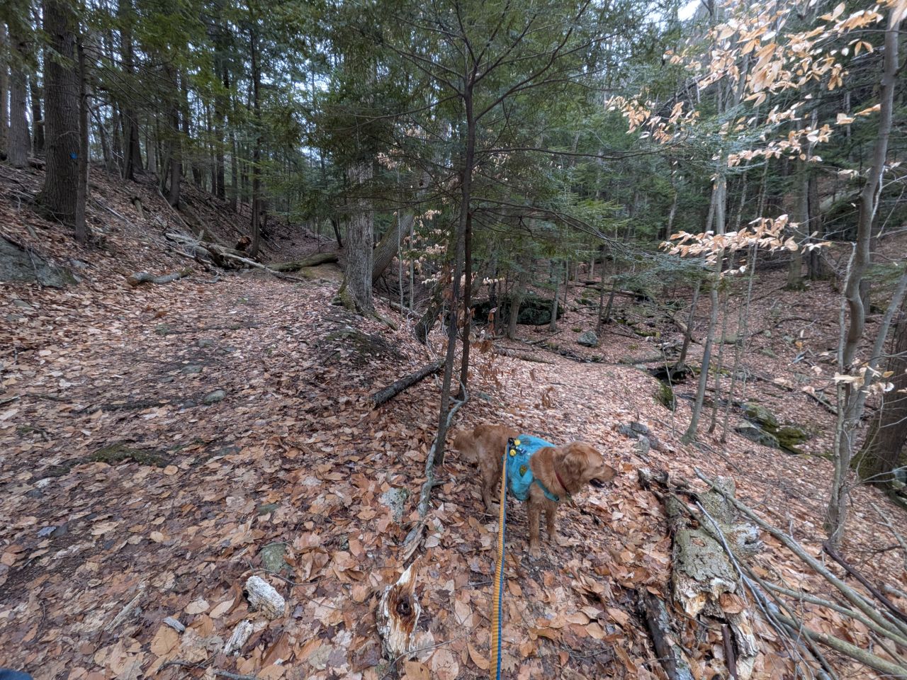
We zoomed up the trail, heading straight at the Inman Pond/Buck junction. The Inman Pond Trail definitely seems to be another old Lake George carriage road. There were a few minor standing puddles and a little bit of ice, but nothing crazy. As I was walking along this trail, it occurred to me I could have actually just parked at the Inman Pond trailhead on the other side without driving all the way out here. Later in this post I'll compare the two routes to see what we might want to try next time.
We found the Pilot Knob herd path junction at 9:05am. It isn't marked at all, but it's fairly obvious.

The trail makes a hard left after the stream crossing. Do not go straight!

After the crossing, the herd path starts off as a gradual climb up the side of the valley, paralleling the Inman Pond trail for a short time.

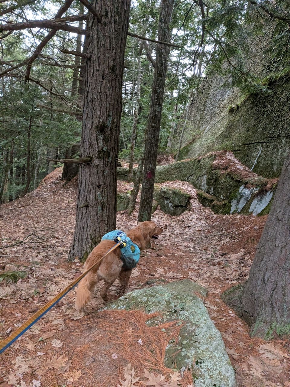
Here is where the maroon spraypaint blazes begin. Thanks to the individual who maintains this; it made the hiking fairly quick and flawless today.

The trail soon makes a hard right and starts to climb in earnest. As you can see, the terrain is pretty much devoid of snow and ice, at least on this side of the mountain. It was really nice to be hiking without snowshoes again. Hiking with boots on is way quieter.

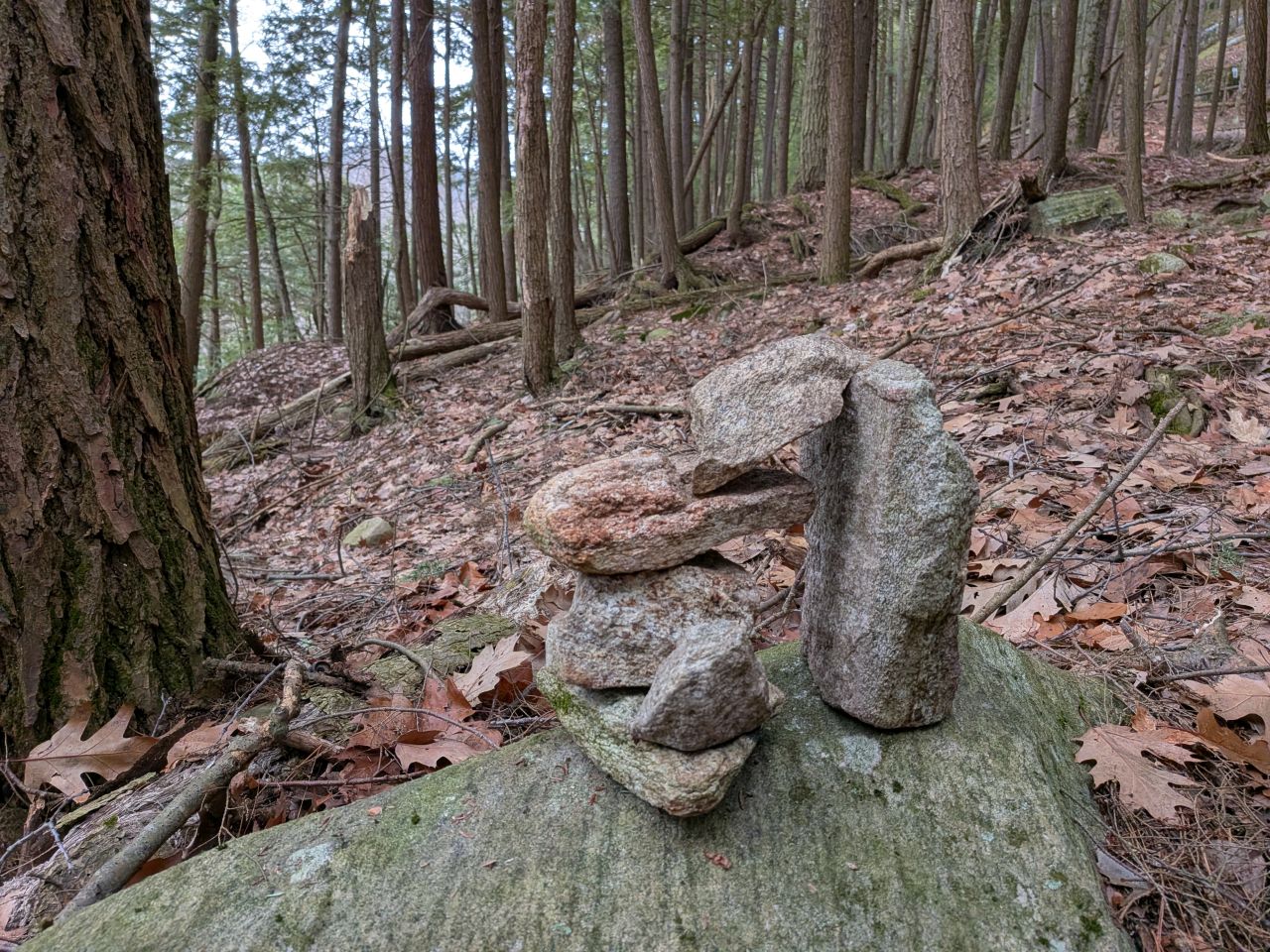
Hikers have also been making an attempt at helping one another. I found one navigational cairn and a blocked herd path on the way up.


You can also tell that other maintenance has been done on this trail from time to time. The trail was quite easy to follow and featured very little blowdown in the way. I think I counted two trees total and I suspect both of those are from this year.

For a short hike to a peak that's only 1900', this trail is quite a challenge. It's steep and rugged, much more difficult than hiking to Buck Mt. from the Northern approach. Our total elevation gain was 1549' (most of that over just 1.5 miles). It'd have been more if we'd hiked to the true summit.

I should clarify, however, the hike was super fun. The steepness and the terrain were really a dream to hike. I'm not sure if it's because I've been hiking in snowshoes for months or what.
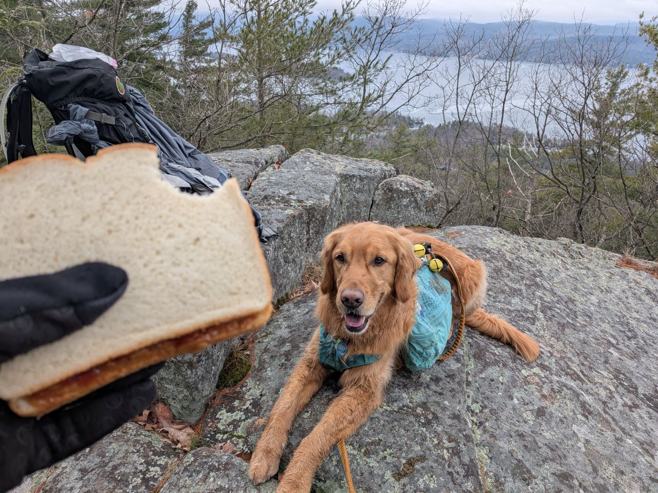
The views of the lake start quite soon in the hike. We stopped at one to take the opportunity to fuel up.
Obviously, much of the hike was rocky climbing, but there were also some switchbacks over turf covered in leaves and needles. There was some ice where water has been seeping out of rocks and earth. I had to be very careful of these when we came back down later because some of them liked to hide.
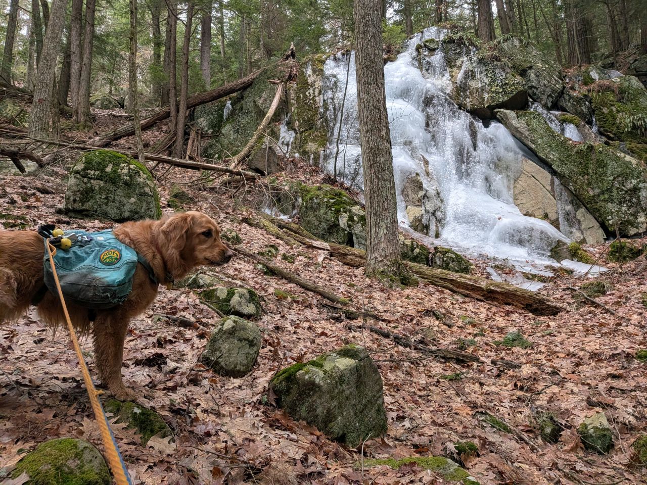
Some icy spots, however, were not hiding. There were a few impressive spring floes which seem to have been thawing and freezing for a few weeks now.

The most impressive floe sat right in the middle of the trail and we definitely had to go around it. It was beautiful to look at, though.

Let's goooooo!

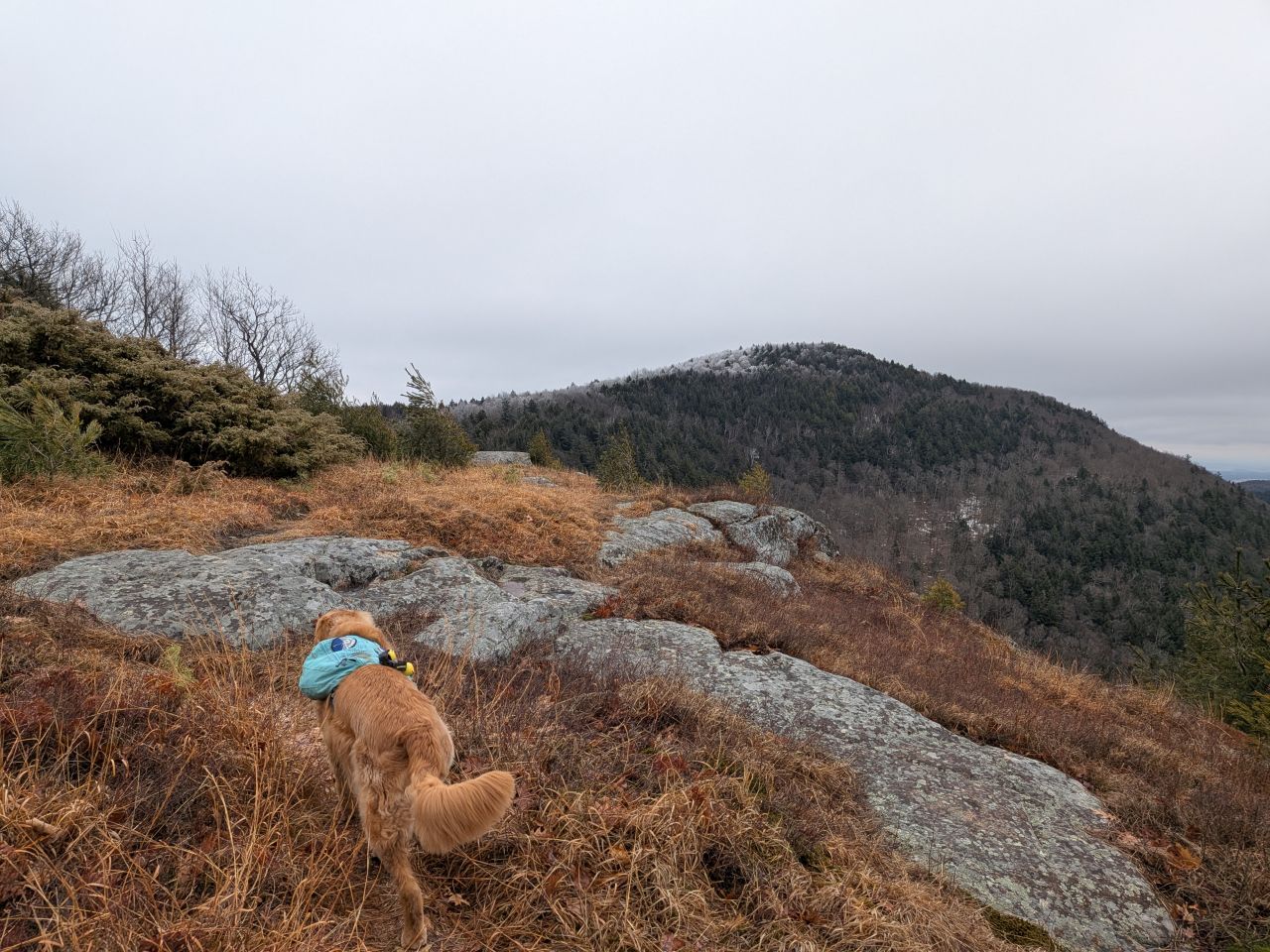
Before long, the trees began to open up and the ground under our feet was getting rockier and slabbier. There were a few blazes up here, but they also started to become largely unnecessary. The trails up here were laid deep in the soil and we tried to stay on them.

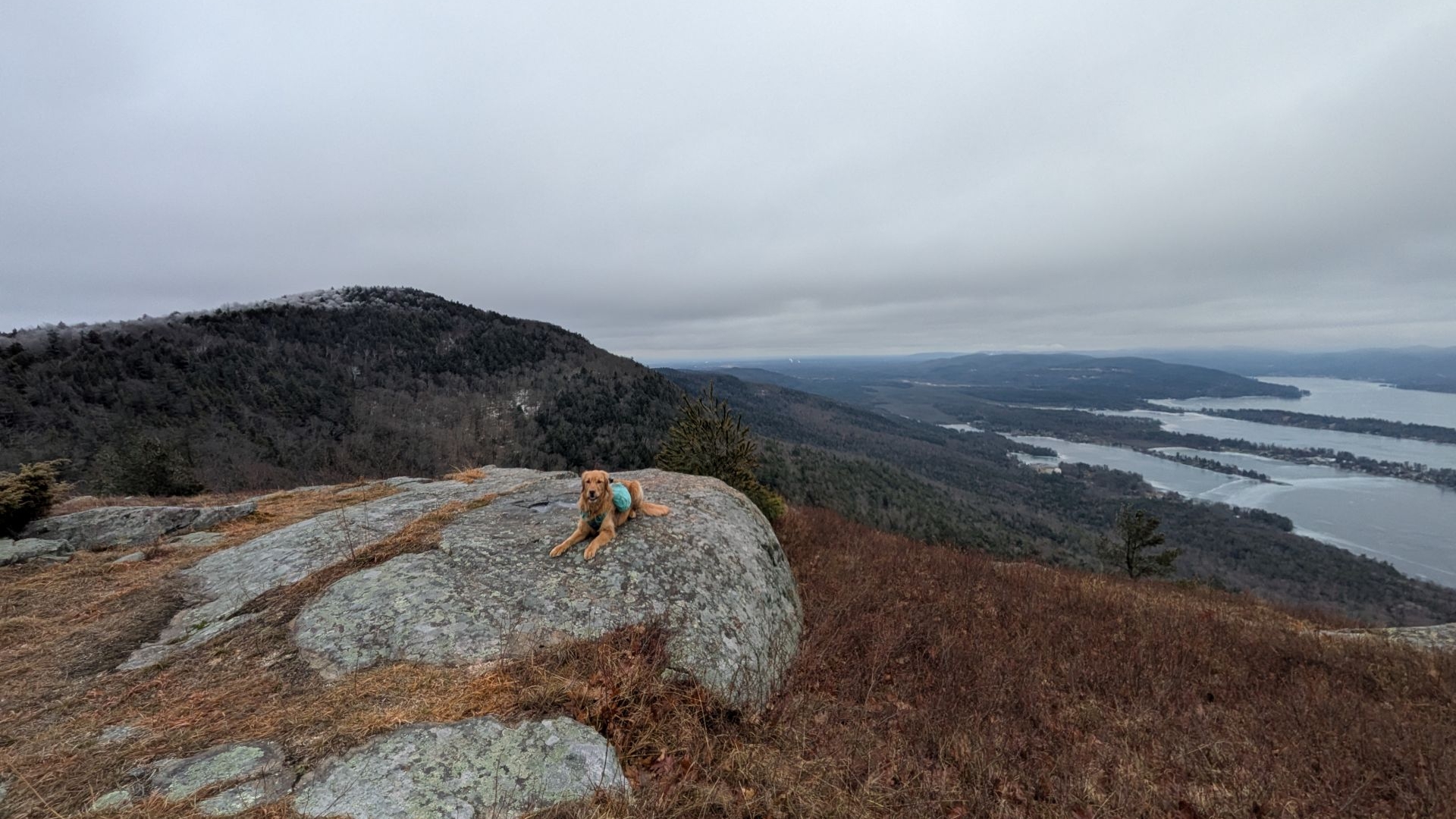
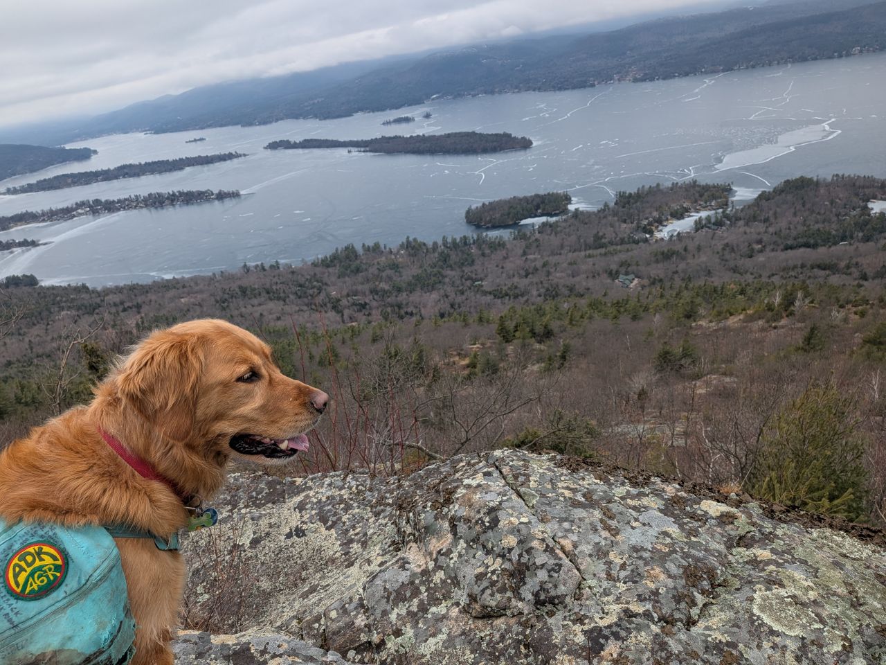
Up here the trail offers incredible views West and South across Lake George and the lands beyond. The wind picked up a bit, obviously, but it was light.

I decided I wanted to hike out to the Southern point of this peak before sitting down for lunch. Sunny and I meandered out there, enjoying the views as we wandered among the grasses and brush up there.
As we gazed across to the true summit, I decided to call the day here. I wanted to sit and relax for a while before heading down and give myself plenty of time to get home. I was really impressed with Pilot Knob and I figured another excuse to come out here and bag the true summit was as good a reason as any. Also, there's a well-known site of an airplane crash over there which would be interesting to see.
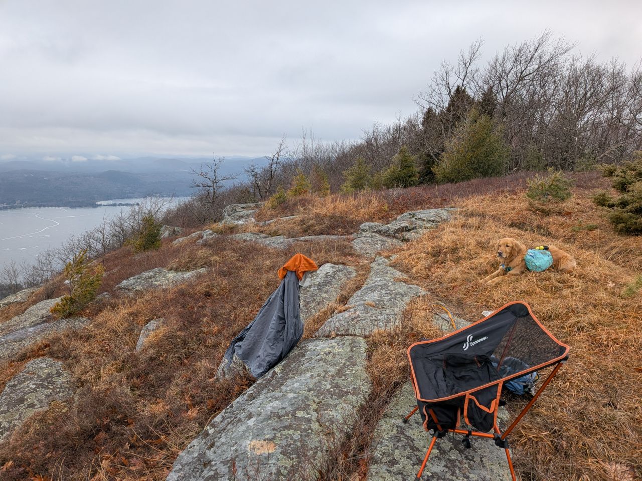
I set up my chair and prepared for relaxation.
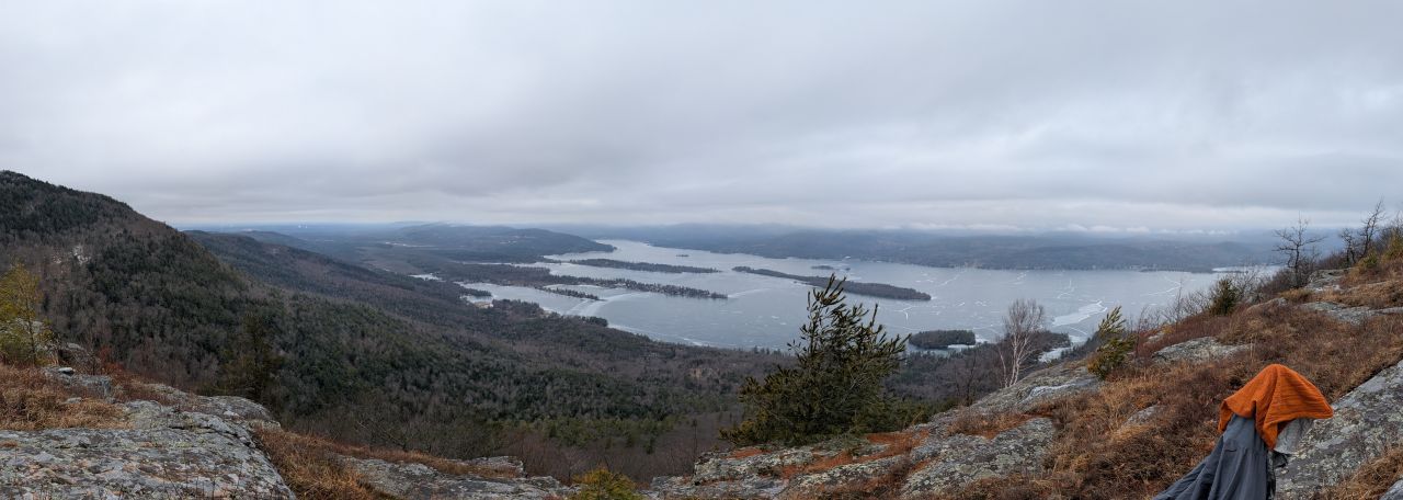
I'm pretty sure the views South from Pilot Knob are better than most of the 12sters on this side of the lake. Cat Mt. has nice views, but from a totally different angle and from quite far away. If I recall, French had a nice view, but more Southeast.

I think this is the first time in 3.5 months that my summit beer hasn't been a beer slushie.

After half an hour of views, brew, and snacks, it was time to head back down the hill.

As we hiked across the ridge, I noticed that Buck was in the clouds and I was glad to have chosen Pilot Knob today.
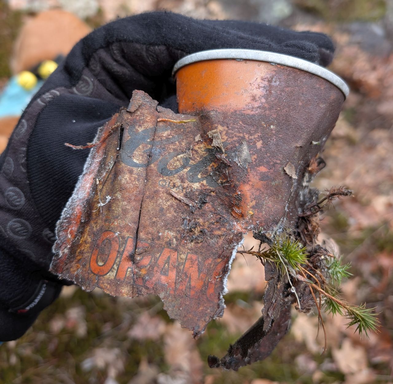
I found a can of Cott Orange Soda from 1973.

We noticed a very pretty verdant pool situated in a little crevasse.

I never tire of looking at frozen springs emerging from the living rock.

Much to Sunny's delight, we came across our first and only hiker of the day. A mail escort by trade, he was quite familiar with dogs, so Sunny got lots of love. After a lovely conversation, we parted ways.

We played a little fetch on the way down.
Sunny and I made it back to the car at 12:45, four hours after we'd started. With a lot of documentation along the way and a bunch of time at the summit, that's not bad for nearly 5 miles and over 1500' of elevation gain.
Next Time

Playing around in mapping software shows that the inman pond route leads to another herd path heading up a steep drainage on the Northeast side. It's about 1 mile longer but with 350' less elevation gain. The x-factor here is the trail conditions. If the Eastern side of the Inman Pond trail is also a former carriage road, then we might be okay, however I wouldn't rule out it being muddy. Also, there's no knowing how well-maintained the herd path on this side is. I suspect this route may also have ice on it currently, but I'm game to give it a try.
Well, it's officially shoulder season up North. I don't know if we'll hike any Catskills. I feel like we can just keep exploring the Lake George region for a while and be satisfied.
Route Map

Morning_hike_along_Pilot_Knob_Ridge.gpx (205.01 KB)