

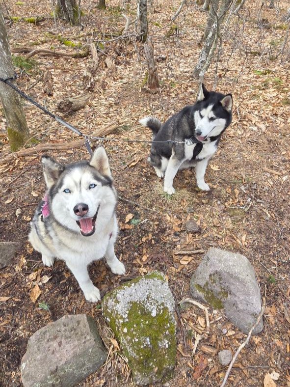
We piled the kids in the Highlander around 6:30. After our 2-hour drive, we were geared up and off to the races at the Biscuit Brook trailhead by 9am. As promised, the sun was shining and the temperatures were very comfortable for hiking.
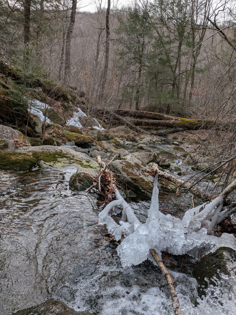
Along the Biscuit Brook

The ground conditions throughout our drive and at the trail register were not only clear of snow but also mud. It was still far to early for anything not brown except evergreens and mosses. Fortunately, the skies were clear and blue. Since we were hiking on the southern end of the range, the sun was bathing everything in sunshine.

There was plenty to drink along the trail.

After a short half mile of easy hiking, the steepness increased. The trail here bends to avoid the Frost Valley YMCA property, thus taking hikers up and over the extreme Southern spur of the range. According to the map, this is actually the steepest part of the entire hike, I assume due to the limitations imposed by this border.

Once we'd crested the ridge, the trail descends slowly along the valley wall. I kind of dreaded climbing back up this on the way back, but the slope was gentle. In addition, this trail was much like other well-traveled trails in the Catskills with hardened surfaces interspersed with flat limestone and slate rocks that were more like pavers than stones.

The surrounding terrain was quite pretty despite the season. The bright sunshine, glittering streams, and hardy mosses made for an idyllic landscape with a primordial feel.
I do have to mention there was a little mud on this part of the trail, but it was mostly isolated to the areas where a fleeting spring stream crossed the trail.


We came to the Biscuit Brook lean-to about 45 minutes after we'd started. The lean-to itself is in a decent state of repair. The site is situated on a ledge about 20 feet up from the brook. This makes for a really picturesque location for camping, but it is a bit of a haul to get water from the brook. The lean-to's thunderbox is in a somewhat exposed location between trails, but modesty isn't exactly the number one priority when camping. Just don't take water from the little spring trickling past it.
We had a quick packs-off snack here before moving on. Also, we took the snow baskets off our trekking poles. Until next year, baskets!

The trail follows the brook and crosses one of the brook's tributaries. This is a very pretty location with some older growth trees still standing and keeping the ground cover sparse. After crossing the stream, we passed the Fir Mountain herd path and continued up the Pine Hill/West Branch Trail. We figured it'd be good to take a straight shot to Eagle and then make a final decision whether to bag Fir later on. The days were getting much longer and we figured we wouldn't need headlamps to navigate the herd path.
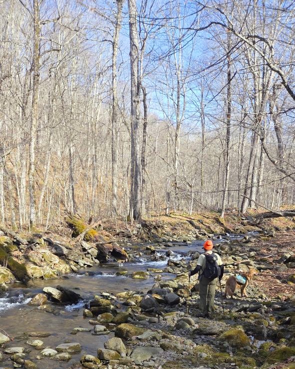
The only major crossing of the day would be the Biscuit Brook. It would have probably been much more difficult downstream, but here there were several spots where we could cross. Jay snapped this photo of Sunny and me trying to make a decision.

We all negotiated the crossing without incident. Fortunately, we wouldn't have to worry about it on the way back because all the water filing this brook comes from the ridge we were hiking today.
Pine Hill/West Branch Trail to Eagle Mountain

The trail follows close to the brook for a short time, but soon begins climbing up the left (Southwest) side of the drainage. The biscuit brook kept us company for the lower portion of the climb with many pretty, little waterfalls tumbling down limestone steps that climbed away in the distance. I doubt the views are quite so nice when the foliage is filled in during other seasons.
This trail is extremely easy to follow. Jay noticed that there are a nearly obscene number of trail markers and I agreed. You're not getting lost out here, that's for sure.
Just below 2500', the trail bends left and follows a more narrow drainage. Still, the trail is to the side of the stream rather than within it. This part of the climb starts off quite steep for about 200' of elevation over .2 mile, but it soon becomes a bit more gradual for the rest of the climb of 800' over about a mile to rim of the ridge.

There were still plenty of little streams crossing our path here. We encouraged the dogs to drink at each opportunity because we knew the ridge top would be unlikely to have much in the way of water. I'd brought a liter just for Sunny, but better safe than sorry. I'm not sure how strongly these will be flowing in other months.

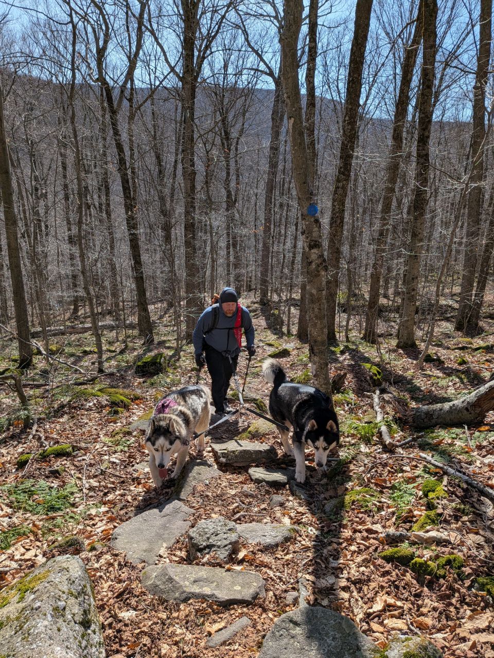
Once we got to the ridge, we started encountering sporadic snow monorails. We were, by no means, enticed to don microspikes, however. For the most part they were rotten, yet firm.
As we hiked across the ridge, I finally let Sunny off his leash. We did a little fetch to celebrate.

You know you're in the Catskills when you see boulders and outcroppings of stratified limestone covered in moss and liverworts. I can't help but stop and take pictures of them.

We hiked along the ridge heading North past Big Indian. We would hit that summit on the way back. For now, we enjoyed the somewhat rugged trail up and down the mountain's shoulder. As we were descending into the col between Big Indian and Eagle, we came across the only other hiker we'd see that day. We exchanged brief pleasantries before parting ways. According to the trail register, there were two other groups out here, but this hiker had climbed directly up Eagle from another trailhead.
It was easy to glimpse Eagle through the bare trees as we descended Big Indian. It did seem quite far away and the elevation seemed higher than the 500' or so promised by the maps. That's always the case up here on the ridges, though. There's a weird summit myopia that inflicts all hikers and I don't believe it can be cured with lasik.

We hit the junction in the col at noon. The Western trail leads down through private land, but before that, a mile down the trail, is the Sandaken Brook Lean-to. We would not be exploring that direction today. We proceeded to the climb up Eagle Mt.

Climbing up Eagle was the most fun part of the day in my opinion. The elevation comes in three or four big "steps" of elevation gain, each featuring lots of exposed rock whether on the trail or outcroppings to the sides.

You comin'?

Clearly I couldn't let this formation go undocumented.

Only 100' to go!

This is what 50' of steep-ish elevation gain looks like.

We claimed the summit of Eagle at around 12:30, three and a half hours after we'd started. Here we sat for a proper lunch break, eating sandwiches and sweets. I've been keeping 1L of water enriched with Liquid IV in a separate container and I drank about a third of this. I would drink another third at the summit of the other two mountains throughout the day.

As usual, the pups were most interested in this part of the hike.
Big Indian Mountain

We headed out from Eagle a bit after 1pm. The descent was super fun with lots of hops and easy aerobic strides, making it back to the junction in less than 25 minutes.

We were all energized from the break and our lunch (and probably the beautiful day). As such, we tackled the ascent back to the shoulder of Big Indian in a relatively short amount of time.


There are a couple of herd paths to the summit of Big Indian. One of them starts downhill a bit from where we emerged on the ridge, so we didn't want to take that one. The other is a straight shot from the Northern side we were coming from. We set off bushwhacking from a clear-ish area and just started climbing. The brush wasn't very thick up here and the season made it hard to stay true to the real herd path.
We eventually came to an open spot that I guessed might be a common stealth campsite, though I also figured not many people had fires here. Moments later, Jay pointed out a fire ring. This area is on the North side of the summit, downhill a bit. The camping rules in the Catskills state that sites above 3500' are illegal, so this would still be an illegal site; I doubt the fire ring was put there by the DEC.

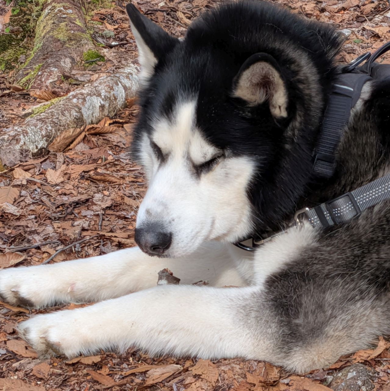
After skirting along the ridge for a bit, we found a spot were it would be easy to ascend the final bit of elevation to the summit. We reached the summit canister at 2:15, about an hour and 15 minutes after we'd left Eagle. We were feeling pretty proud of ourselves. We took our packs off and had another snack and I drank my summit beer.
Korra: What a great day! Zuko: Say what??
Fir Mountain

At around 2:40, we decided it was time to tackle the herd path to Fir Mt. 1.7 miles East along the ridge. The col would be 500' down from Big Indian followed by about a 450' climb to Fir's summit.
We gained and lost the trail several times on this part of the hike. We knew that we really just had to maintain our path along the ridge and just be sure to aim our bearing properly from the col.
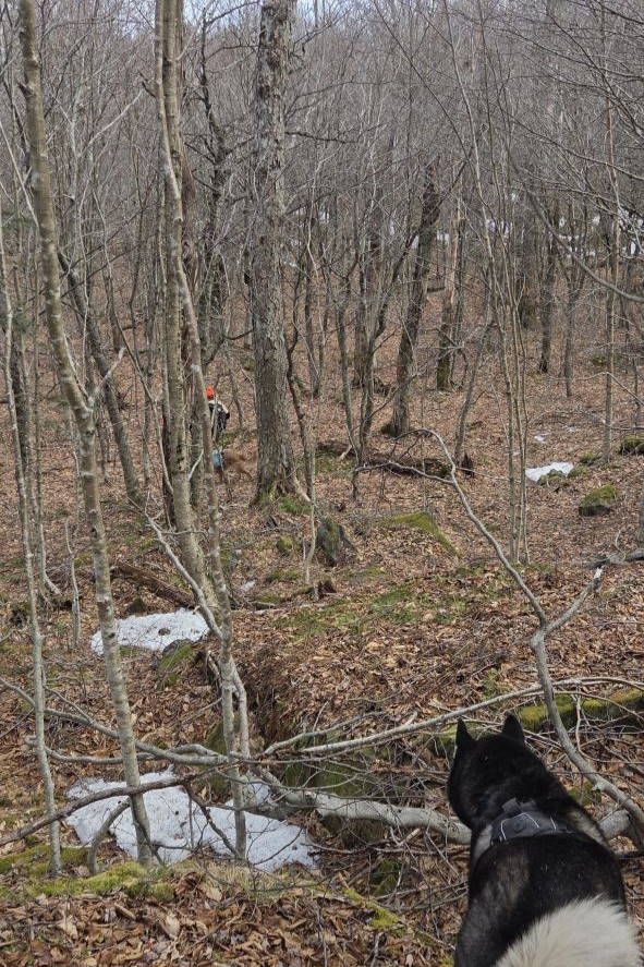
Sunny did a really great job sniffing out the trail. Twice along the descent, at the points where there's a steep ledge, I second-guessed him and got us off the mark until we could find the path again. I also blamed the sporadic bits of snow for confusing Sunny's nose. However, I soon realized that wasn't the case. Rather, there were spots where snow monorails were still filling the trail. There were other crescent-shaped strips of snow everywhere, but I had to keep an eye out for actual areas of the trail that didn't look like herd path, but instead looked like monorail. Sunny was fairly reliably sniffing these out, I'd just been dubious about it.
To make a long story short, I started trusting Sunny more and also keeping my eyes peeled for hard-packed monorails with footprints in them. Once I corrected in this way, we made much better time, following the actual herd path almost the entire way. To be clear, following map and compass would have been very easy up here, but it's a lot faster to hike on the trail.

Another awesome limestone hollow that begged to be documented.

We claimed the summit about an hour and a half after we'd started, at 4:05pm. Our split pace from Big Indian to Fir was 38 minutes, but that's really not terrible considering the challenging nature of the hike.

I'd originally lobbied to simply pause at Fir for a photo before moving on, but after the hard work we'd put in to climb it, we decided on a proper break. The puppies absolutely agreed with this decision. I even took my boots off for a spell! As he signed the summit log, Jay noted that several people had been up here prior to us today, more than had been signed in at the register below. We wondered if the herd path we were about to take was more popular than we thought or if they'd come from the Northern bushwhack.
Like the rest of these 3600' summits, Fir was covered with mixed forest, the trees much taller than the trees on the summits of the Adirondack high peaks. The wind was howling through the trees and Jay but we were lucky that these wooded summits were blocking the worst of it.
While we were up there, I grabbed a ziploc and used it like a dog waste bag to pick up toilet paper all over the summit. People are so gross. I wish folks would pack it out, bury it, buy a kula cloth, or make like Taylor Swift and shake it off.
Down & Out via Fir Herd Path

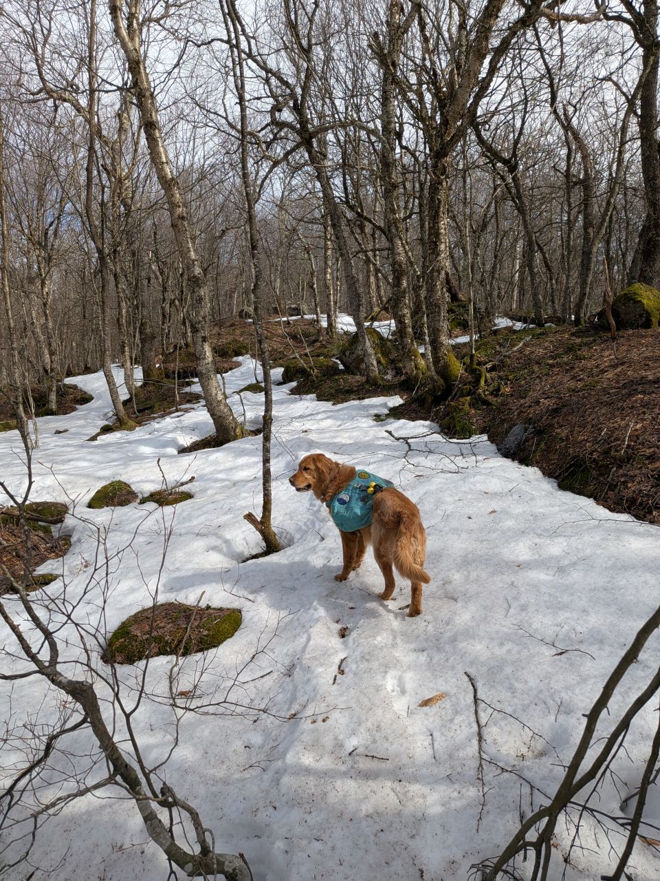
We left the summit 20 minutes later at 4:23. It quickly became evident that the Fir herd path was going to be very easy to follow. It was clear that this is a path that is used very often by hikers to bag this peak.

There was unsurprisingly no snow on this side of the mountain and Sunny's sniffer stayed true the entire hike down.
At some point, he finally did a #2 and I tried digging a hole for it. Unfortunately, the ground was just way too stony for a cat hole. Instead, I picked it up with a poo bag and put that in the the big ziploc I keep for this in the Winter, and then dropped that in our red trash bag with the rest of the garbage and the toilet paper scraps from earlier. Sunny carried all that out in his pack for us. This has solidified the need for me to carry a sturdy ziploc all the time, not just in the Winter.
On a positive note, after lightening his load, he perked up and got his second wind.

The trail was extremely well-worn with firm, hard-packed earth and limestone "pavers". I joked that if this trail had markers, it'd have been easier to follow than the one we'd climbed up this morning.
As easy as the trail was to follow, the descent seemed absolutely endless to both of us. Losing 1300' of elevation doesn't usually feel so laborious but there were a few factors at play. Obviously, the fact that we'd already hiked 12 miles today played a part in how we felt. However, the descent was spread out over 1.7 miles which is kind of long compared to what we're used to.

The trail eventually levels out a bit and follows a stream to our left. This is the tributary of the Biscuit Brook we'd be re-crossing later. Beyond the trees, the little valley was still striped with snow and ice. The stream itself was moving with gusto. It was quite pretty to look at, though too obscured for a good photo. It was a view for the memory, not for sharing on the internet.
We were crossing the stream by 5:20. We took a short break here, but we were also eager to be on the move. Visions of pizza or some other hot meal were dancing in our heads.

Best day ever!

I couldn't help but take another picture of the trail following the bend near where the tributary meets the Biscuit Brook and the stand of older trees. I wouldn't mind camping at the lean-to someday and just spending the entire time with my relax-a-chair here at the junction with a book.

We were back at the car by 6:20, nine hours and 20 minutes after we'd started. According to AllTrails, our moving time was 7 hours and 40 minutes with an average split pace of 28:43. With a distance of 16 miles and elevation gain over 3500', we declared that a rousing success.
Some might look at all of that rest time as a weakness, but I think it was the right amount. All of those breaks were deliberate and restorative. I don't think our split pace would have been nearly as strong without them.
Also, I believe it's important to enjoy your victories. Sure, these summits don't have views, but that's not always the point. Indeed, I think the Catskills seem to be more about the challenge and the personal journey than chasing views. I've always liked that aspect of hiking the High Peaks as well, but the Catskills take it to another level. For the most part, the journey is the reward and you have to make peace with that. If you can, I think you'll be successful. Take Chili Heeler's advice and try to focus less on making good time and focus more on making good times.


Jay had pointed out a restaurant advertising wood-fired pizza on the way in somewhere on 28. After driving for a bit, he finally got service and found that the place was open. We made a bee-line for Brio's in Phoenicia. The serving staff were super friendly, inviting and helpful. We ordered the pork belly "wings" to start and they were phenomenal. I think the flavor was lime chili. For our entree, we shared a Aunt Mary’s Friday Night pizza (hand-pressed, thick crust w/ pomodoro sauce, garlic, basil, sausage, mushroom, and fresh mozz). It was next-level.
We will be back.
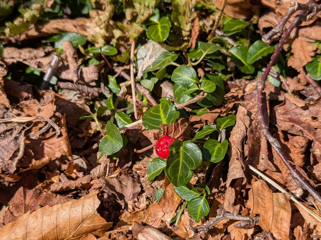
Partridgeberry, an evergreen whose berries stay on-vine until the next flowering season.
It was a great day in the woods; a proper challenge. Sunny and I were definitely feeling it the next morning, but the hike was absolutely restorative. The brown season can be a bit glum, but it's better than spending the day indoors, much less at the the office. Hopefully it'll help keep the batteries charged until next time. What will we do next? Who knows. These days I feel like the world is our oyster.
Route Map
