
Phelps Trail. Again.
A major snowstorm was hitting the East coast and forecasts were dubious as to whether we would get a bunch of snow or it would miss us. Nick agreed to pick me up in his truck the morning of the hike in case we need some traction. As it turns out, we just got a heavy dusting which cleared up completely by the time we were on the Northway.

This would be my eighth trip out from The Garden in my hiking career. When we pulled up to the lot, of course the "Parking Lot Full" sign was out. Also of course, it was not that the lot was actually full, but because nobody had returned to cover it or remove it after the previous day. I'm sure it had been full yesterday, however; Sunday had been a really perfect day.
We got signed in at 8:15 and the air temps were 25 degrees with no wind. I immediately regretted not bringing Sunny. Still, we were in good spirits and ready for the big day ahead.

Like Sunny, Stella was incredibly excited to get moving. I took rearguard for our trip down the Phelps Trail. The trail was packed and fast. I bet the traffic was quite heavy over the weekend. Nick commented that the snow was pretty great for skiing. There were lots of ski tracks amidst the snowshoe tracks. We saw no evidence of post-holes on the trail today.

As we descended down into John's Brook Valley at the end of this leg of our adventure, we cringed at the thought of coming back up on the way back. It's only 130' of elevation, but it would feel like more after climbing a big ol' mountain.

On the way in and out we enjoyed the views of the Northern end of the Great Range through the trees. It's something you really don't get to see in the Summer. We were heartened by the fact that the summit of Lower Wolfjaw was, for the time being, clear of clouds or blowing snow. I hoped that the wind that was forecast would hold off until we achieved the summit.

It was a beautiful morning with perfect conditions for a Winter hike. We made great time, clearing the three miles from the Garden to the DEC interior outpost trail register in one and a half hours. We hung out on the porch at the outpost for a while, snacking and hydrating.
Wolf Jaw Trail

We made our way across the meadow beside the outpost at 10am. It was still in the mid-20s Fahrenheit with almost no wind. The sun would never make an appearance today, but this was fine by me because I'd left my sunglasses in the car. Since the cloud ceiling was high, it really wasn't an inconvenience.

Stella wasn't too sure about the suspension bridge across the John's Brook, but with several hundred pounds of snow on it, it barely bounced. I'm not sure it really mattered for this particular bridge which is in incredible shape, but we did take turns crossing for safety.
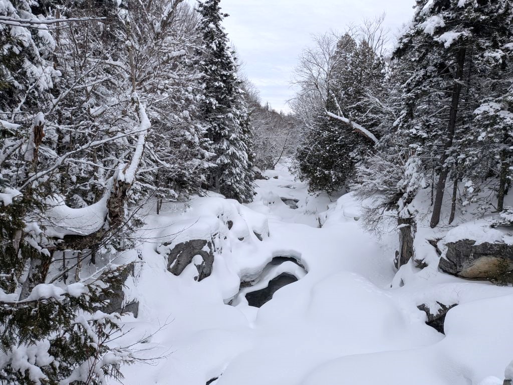
The John's Brook is pretty no matter what season it is.

We reached the Southside/Wolf Jaw junction at 10:05. The real hike began.

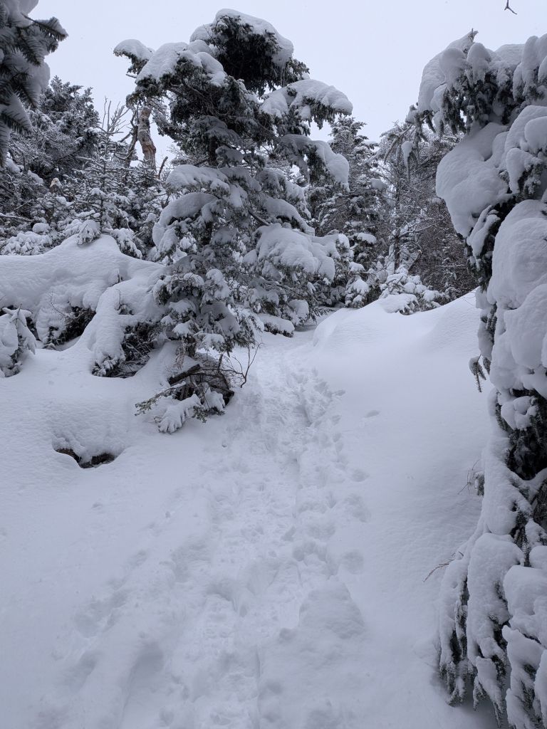
The snow was definitely deeper on the trail here, but it did have at least one set of ski tracks through it. The ski tracks led up to the place where the slides on the West side of Lower Wolfjaw meet with Wolfjaw Brook. There, unsurprisingly, the ski tracks immediately broke from the trail and headed for the slides.

After the ski tracks disappeared, the trail had a good 6 to 8 inches of fresh snow in the snowshoe channel. It wasn't terribly difficult to climb. Since we'd been hiking over three miles, Stella had chilled a bit, so I could take point for a while.
This was the first time I'd been on this part of the trail and I was interested to see the camping here. I didn't actually break from the trail to get details, but there were quite a few sites and there was lots of open terrain here. The Wolfjaw brook, though covered in ice and snow right now, seemed to me to be quite girthsome where it passes by the campsites and lean-to. I can definitely see myself camping here when I get a bit older and can't do Gothics as a day hike anymore.

There are a lot of junctions along the Wolf Jaw trail. We climbed the 1300' from the Wolf Jaw/Southside junction to the Wolf Jaw/Range/White junction in about an hour and a half. We hung out there for a bit, taking in calories and water. I put on my puffy and stuffed my face with PBJ and electrolytes. Nick scouted ahead to stay warm and I followed shortly after.
W. A. White Trail
The snow depths varied as we ascended. I was a bit happy to see the ornery, stunted high-altitude trees covered in snow. Hello, old friends!

I made sure to stop and enjoy the view of Upper Wolfjaw as I climbed.

The trail got tight. In my mind, I was expecting a more exposed ascent, but I hadn't really looked at the satellite image for this hike. If I had, I'd have seen that the spur (which the trail follows) is wooded with a pair of cliffs flanking both sides. The climb is steep, but not too slabby.


Still, there are a few places where spring water has seeped from the rock and has formed slabs of ice. I found the first big one I came to to be quite impossible to scale with my snowshoes. I nearly made it to the top, but slid down, thus clearing all the remaining snow off it. I tried going around it, but it was all spruce and more ice on either side. I was forced to switch from snowshoes to microspikes. All told, I wasted about 20 minutes scaling this 15' of elevation.
I really need to buy a larger pair of microspikes that fit better over my snow boots. As a 10.5 Wide, my 3-season boots fit a medium sized microspike, but my winter boots really need a large.
I kept my spikes on for the remainder of the climb in case I faced more sections like that one (which I did). Fortunately, the trail was well-packed and I was able to keep on the durable surface without punching through. Nick met me a couple hundred feet up and we climbed the rest of the way to the summit.

We made the summit at nearly 1pm, three hours after we'd left the Wolf Jaw/Southside junction, meaning the last half mile had taken me about an hour and fifteen minutes (accounting for the last break). At the summit we were greeted somewhat stronger winds, but also gorgeous views. Luckily, the cloud ceiling had stayed high and the really powerful winds had held off. We were able to get a bunch of photos before retreating back into the trees for a snack and some water.

This shot of Marcy and Algonquin (and everything between) is probably my best landscape shot of the hike.

Of course, Big Slide is a major landmark from this point, but Whiteface was also quite visible in the distance.

Nick took a great shot of the Colvin range and Dix beyond on the way back down. I failed to get a shot of Gothics which I kind of kicked myself for, but it was definitely getting cold.
Sliding Into Home
I was eager for some epic butt-sliding. I'd brought my snowpants for this purpose, but I was still fairly comfortable and was feeling bad about holding us up with my microspike debacke. The new pair of REI pants Wendy got me are much nicer than any hiking pants I've ever owned. Water and snow just slide off them. Also, apparently, the pants slide on snow!

Screengrab from a video of me sliding down the mountain.
For the first couple of slides my legs cramped up pretty bad, but I pushed through the pain in the name of adrenaline. I zoomed down, with Nick and Stella hopping down behind me. That last .5 mile that had taken me an hour and fifteen minutes to go up instead took us 20 minutes to descend.

We did another heckin' snack break to prepare ourselves for the epic cardio we were about to engage in. Stella seems to have the same expectations of Nick as Sunny does of me.

Stella was still having fun, diving in the snow in search of rodents. We also saw signs of a weasel of some variety, but never saw the animal itself.

The descent was fun. The wind had picked up, but the air temperature was increasing as we descended and we were on the move, so we stayed warm. When we got near the bottom of the descent, Nick said he noticed there were fresh ski tracks made by folk who had come down from the slides while we'd been up top. Skiing sounds like fun and Dan has offered to teach me. I haven't decided whether or not this would be a good skill to learn or another great way to get myself killed.

I caught Stella pretending to read.

We arrived back at the Southside junction at 2:45, an hour and a half after we left the summit. It had officially taken us half the time to descend Lower Wolfjaw than it had taken us to ascend it.
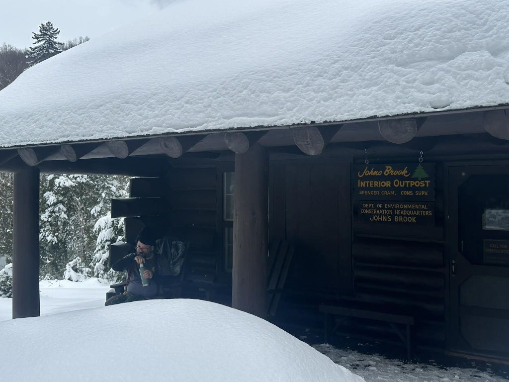
We took another extended break on the outpost porch. I took in more PBJ, more electrolytes, and more Tylenol. Stella got some PBJ, of course. While on our break, Nick saw a few people hiking and skiing through.

As expected, the little 130' climb out of the valley from the John's Brook was brutal. Still, the hike out was a lot faster than I thought it would be. I warned Nick that, by all rights, we should make it back to the trailhead by 4:30 (an hour and a half), but not to get his hopes up. He was cool and let me take point on the hike out and we actually did make it back to the trailhead at 4:30 on the money.
A father/daughter duo was hiking out as well. They said they'd hiked Saddleback and almost all the way up Gothics. Unfortunately, they were most of the way up Gothics when the wind kicked up and visibility had dropped significantly. They made the good decision to turn back and try for it another day.

Stella did a great job today and she's now at 38/46. Thanks so much to Nick for letting me tag along. Hopefully we can get together for the rest of the Lower Great Range when the weather gets nicer.
I was really glad to test my own mettle on a bigger mountain in the winter. I do feel like I was pushing some kind of limit, but I have a tendency to think that when it isn't true. Snowshoeing the High Peaks is definitely a different animal; my legs have never been more sore! Still, when all was said and done, it was another great day in the woods. The batteries have been recharged, hopefully until next time.
Route Map

Afternoon_hike_at_Lower_Wolfjaw_Three_Ways.gpx (454.13 KB)